Why we oppose development at Shortlands Farm

The proposal for up to 200 houses on protected Green Belt land would irreversibly damage Wyke’s rural character. Open farmland and fields that connect our countryside would be replaced with rows of cookiecutter townhouses and driveways.

This scheme would push urban sprawl deeper into Normandy, cutting through the green spaces that link our village to the wider landscape. It sits less than 300 metres from the Thames Basin Heaths SPA and Ash to Brookwood Heaths SSSI, placing additional pressure on these nationally important habitats. The site currently acts as floodwater storage and supports a range of wildlife including reptiles, bats, birds, and pollinators, values that would be diminished by development.

The developer needs a 20% Biodiversity Net Gain (BNG) but will only achieve this by paying to offset the ecological damage elsewhere, leaving Wyke poorer in nature.

Gleeson Land Ltd and Nathaniel Lichfield & Partners, based in Sheffield and London, have no roots here and no stake in preserving the heritage, landscapes, or community they would permanently alter.


DOWNLOAD materials and JOIN the campaign.

Hedgerows and farmland habitat

Nature & Landscape

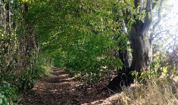
The fields, hedgerows, ditches, and veteran trees here form a living network for birds, bats, pollinators, and protected species. Building over these features fragments habitat and erodes the countryside setting that residents value.

Floodplain and surface water run-off

Landscape & Heritage

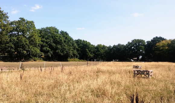
Shortlands Farm is part of the last stretch of open countryside between Wyke and Ash, forming a green backdrop to our village and a link to the wider Surrey Hills landscape. The fields also form part of the historic setting of two Grade II listed buildings: York House and East Wyke Farm, whose rural surroundings contribute to their significance. Once lost, this landscape and its cultural associations cannot be restored.

Traffic congestion on local roads

Traffic & Services

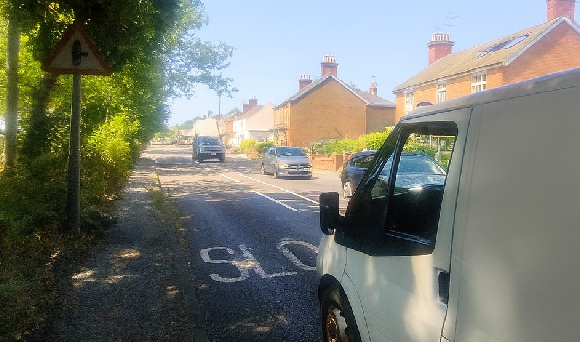
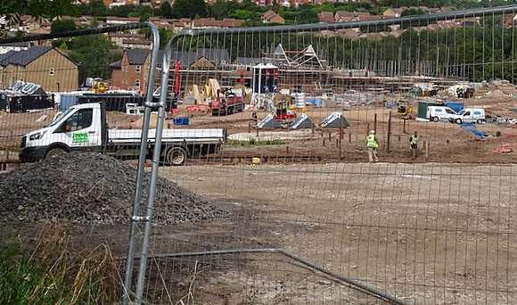
Guildford Road is already congested at peak times. This development would add a new access road, funnelling traffic straight into the bottleneck, hundreds of extra cars every day. Local schools are already stretched, and there is no spare capacity to absorb the children from 200 new families.

What this first application really means

This “screening opinion” request is the developer’s first formal step towards securing permission to build 200 houses on Shortlands Farm.

By submitting it, Gleeson Land and their planning consultants, Lichfields, are already acting as if this scheme will go ahead, before the community has even had its say.

They are asking Guildford Borough Council to confirm that they do not have to carry out a full Environmental Impact Assessment (EIA). An EIA is a legally robust process that would force them to properly investigate, document, and publish the full scale of environmental harm their plans could cause. Avoiding an EIA makes it cheaper and quicker for them to push the project through, while leaving critical questions unanswered.

This early move is telling:
  • It signals their confidence that development will go ahead, rather than something that must earn public and planning approval.


  • It attempts to limit scrutiny on sensitive issues. Including impacts on nearby protected sites, the loss of wildlife habitats and the erosion of our rural landscape.


  • It sets the tone for the rest of the process: a developer-led timetable, designed for speed, not community consent or a care for due planning process.


If we do not challenge this now, we risk the Council making early decisions that shape the entire application in the developer’s favour.

WE NEED TO ACT NOW.

Evidence & Maps

Explore the site and the issues in more detail. Click a card to see more.

Site overview map thumbnail

Site Location Map

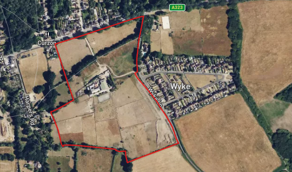
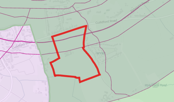
Where is the site and what is the current redline boundary? Consider how this will impact YOU and mention it in your objection.

Habitats and hedgerows thumbnail

Cumulative Impact from Other Development

At least five other housing schemes are within 500m, totalling several hundred dwellings, plus a potential 1,100-home site at Normandy/Flexford. Isn't this enough evidence that these schemes do have an impact?

Flood risk thumbnail

Impact Risk Map

The evidence here shows the site will impact nationally important protected sites. The site is clearly being built on the Green Belt. It must have an Environmental Impact Assessment.

Campaign Updates

Key dates and what happens next.

Timeline thumbnail

Timeline

Consultations, committee meetings and deadlines.

How to object thumbnail

How to Object

Material planning reasons to cite in your response.

Resources thumbnail

Resources

Posters, leaflets, template letters and social media assets.

Take Action NOW

Add your voice. We will send you key dates and how to object effectively.